
Cross Border Routes
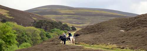
The Cross Border Drove Road is an old drove road winding its way over the rolling hills and through the sheltered glens of the Tweed Valley and makes a lovely riding trail. From the 16th to the mid 19th century cattle and sheep were driven along this route between the trysts (markets or fairs) in Falkirk and Crieff and markets south of the border. This route is part of the 350km South of Scotland Countryside Trails (SoSCT) network.
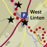
Larger scale maps should be used to follow routes on the ground, such as OS Landranger Maps 1:50,000 no. 72 (Upper Clyde Valley) and no. 73 (Peebles, Galashiels and Selkirk), Explorer Maps 1:25,000 no336 (Biggar and Broughton), no. 337 (Peebles and Innerleithen), no338 (Galashiels, Selkirk and Melrose) and no. 344 (Pentland Hills).
Route Description
This old drove road is a linear riding route starting at the regional boundary high on the Pentlands, leading through West Linton to Peebles and Traquair, and onward to the Yarrow Valley. Various sections of the drove road still run between the parallel dykes, which once helped the drovers prevent their stock form straying. Elsewhere the route climbs over open hill, or follows forest tracks, which have been built on top of the former drove road.
The mainstay of the droving trade was the movement of hardy black cattle from where they were bred in the Highlands and Islands to London, the home of one fifth of the entire English population. Each drove consisted of anything between 100 and 1,000 head of cattle. Individual drovers and their dogs might look after 50-60 cattle, walking 10-12 miles each and every day for weeks on end. The drovers slept alongside their cattle to guard them overnight, wrapped only in their plaids, surviving on a few handfuls of oatmeal and two or three onions. A ram’s horn filled with whisky was sipped sparingly morning and night.
At the peak of the droving trade, some 100,000 cattle were walked south from Scotland each year. At least equal numbers of sheep were also driven along this route to meet demand for wool and mutton. By 1900, the droving trade had all but disappeared. Tolls levied on turnpike roads, enclosure of land, the agricultural revolution, development of railways and movement of cattle by steamship all played their part in its demise. Long after the demise of droving, people continued to use the old drove roads on foot and on horseback.
The Tweed Trails route follows the main drove road south east to Gypsy Glen, but various branch routes were also used, some merging at Tushielaw Inn, others via Traquair linking up again further south towards Hawick. One route went on via Langholm to Carlisle, whilst others crossed into England near Newcasleton or followed the valley of the North Tyne to Hexham.